Behind the scenes
Image
Reply
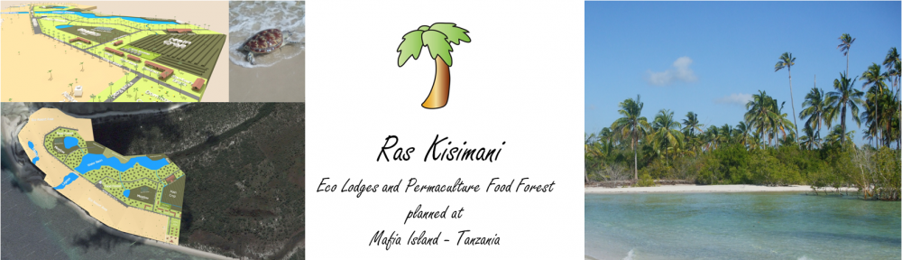

On the 18th of June 2014 new satellite images have been made of RK. On this image you can see our base from which we operate and the maize fields intercropped with several vegetables and nitrogen fixing plants like cow-peas. On the right we have made a small road by widening an excisting path to enclose our premises.
The yellow lines show the proposed area’s for the eco lodge and farm area.
Left next to the yellow borderline on the right shows a brownish area. This section has just been cleaned of weed bushes, leaving all valuable domestic vegetation like monkey fruit, almond, coconut and mango. After that nitrogen fixers will be planted, combined with various other fruit and nut trees.

Greg from Australia, arrived last week and freshly married with Sarah who is also accompanying us on RK, is seen here digging for caliche. This is a deposit layer we hope to find right above our groundwater level. This can be used for building houses ,roads and several other purposes.
